
The geophysical methods, the combination of which are used by the consultancy firm, cover a wide range of applications in geological and environmental survey and geotechnical engineering, the main of which are:
- Survey and identification of aquifers. Water resources management (surveying subsurface flows and sources of enrichment zones). Enrichment Studies of groundwater aquifers.
- Survey , prospection and exploration of deposits.
- Identification and spatial assessment of mineralized zones.
- Survey of geothermal fields.
- Geotechnical survey - Technical Geology. Quality control of rock mass. Assessment of the characteristics and quality of the successive natural soil formations and identification of the measures of their dynamic properties for craftmanship design.
- Design of drilling research projects.
- Geological - tectonic - seismotectonic mapping.
- Mapping and identification of stratigraphy, quality of rock, hydrogeological conditions and subsurface morphology .
- Locating unexploded explosives (UXOs).
- Mining - quarrying survey.
- Study of soil instability, subsidence, landslides and soil creep.
- Archaeometry research (locating subsurface and other constructions and metallic or non-metallic targets of archaeological interest).
- Oil and mineral resources survey .
- Quality and geochemistry identification of groundwater and surface water bodies. Establishing salination zones and possible pollution zones.
- Detection- mapping and study of the geometrical characteristics of geological faults.
- Survey and detection of caves, tunnels, cavities, ducts, underground reservoirs (tanks) and generally karst structures.
- Study, survey and quality control of structures, engineering structures , foundations and reinforcement components. Precise imprinting of road layers.
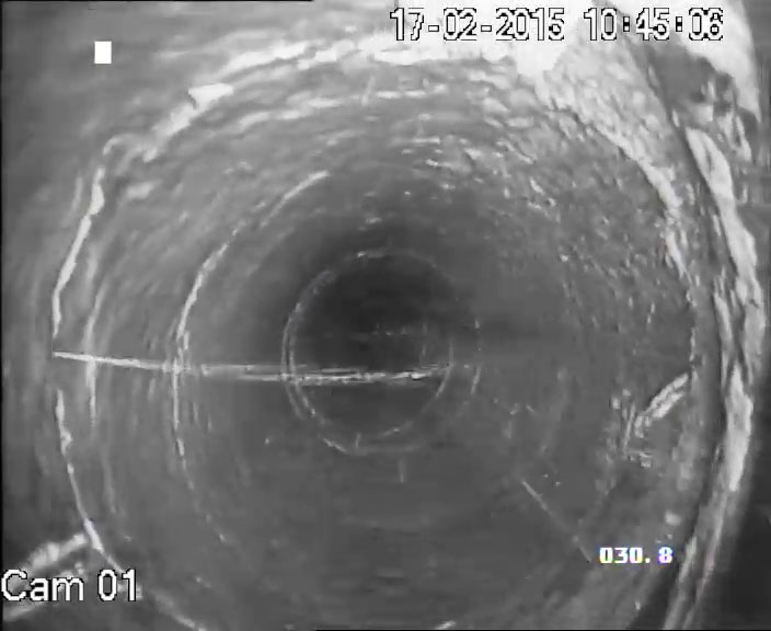
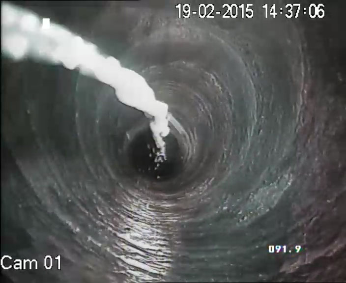
- Survey and identification of dam leaks, reservoirs, sewers and any kind of underground pipes and tanks).
- Environmental research.
- Construction Control and drilling control. Determination of hydrogeological characteristics and quality of groundwater.
- Applications of military interest.
- Assessment of suitability of waste deposition positions, sanitary landfill
Geophysical methods
| Electromagnetic methods of fundoscopy: transient waves TEM and NANOTEM |
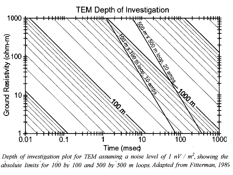
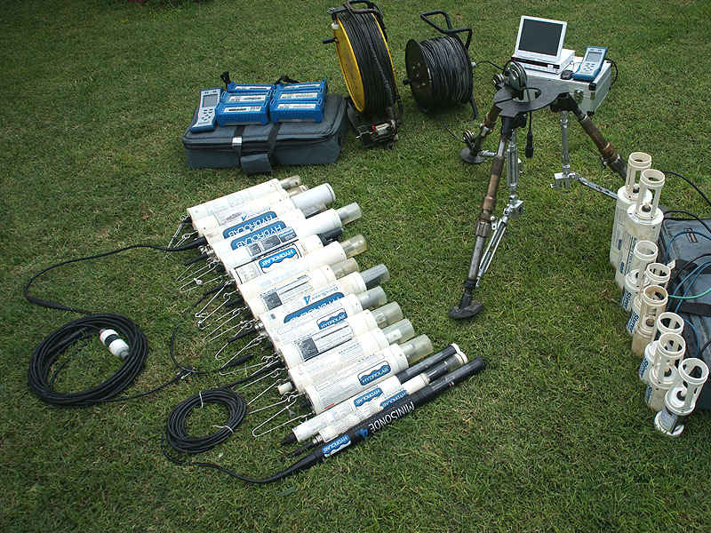
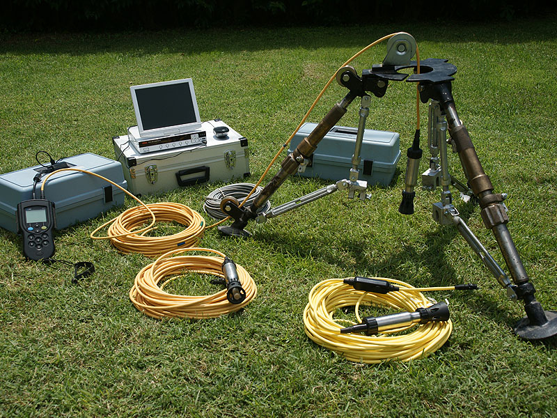
The office has the following geophysical instruments: GDP-32 receiver (6 channels), ZT 30 Transmitter (max output current 30A), NT 20 Transmitter (max output current 20A), NANOTEM receiver, XMT-32 Controller and Magnetic sensors TEM-3 (of the american company ZONGE ENGINEERING). For the processing and interpretation of the measurements we use DATPRO software and STEMINV. To receive measurements the Tem provisions applied are: In Loop, Moving Loop and Fix Loop. The depth of the geophysical exploration, depending on the conductivity of the subsoil, the layout and the dimensions of the bronchi (loops), may be more than 1200m. |
|
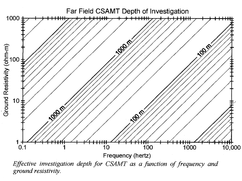
Electromagnetic methods of fundometry:
|
The office has the following geophysical instruments: GDP-32 receiver (6 channels), ZT 30 Transmitter (max output current 30A), XMT-32 Controller andMagnetic sensors ANT-3 και ANT-4 (of the american company ZONGE ENGINEERING). For the processing and interpretation of the measurements the software used is: DATPRO, CSAMT, EM2D and SCS2D. The depth of the geophysical exploration, depending on the used measurement receiving frequency (0.125 to 8,000 Hz), the dimensions of the dipole (transmitter - receiver) and the conductivity of the subsurface, can be more than 1500m.
|
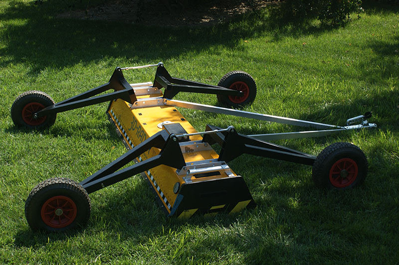
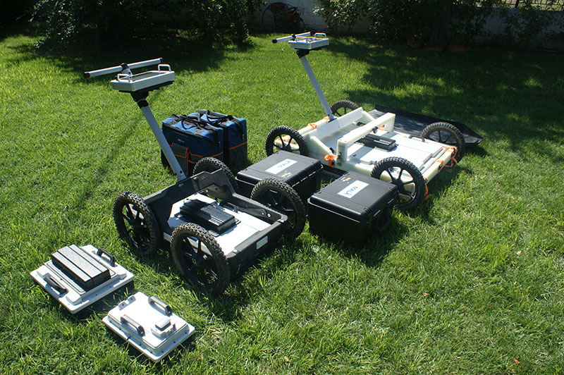
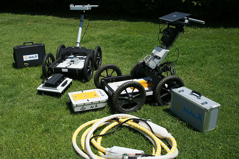
| Electromagnetic method of GPR (Ground Penetrating Radar) |
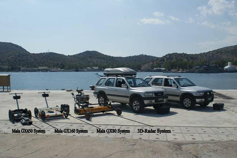
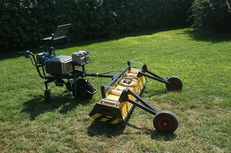
1. The 3D-Radar GPR system. This system has pioneered next generation 3D Ground Penetrating Radar (3D GPR) using step frequency radar technology and innovative multi channel antenna design. The Antenna arrays are:
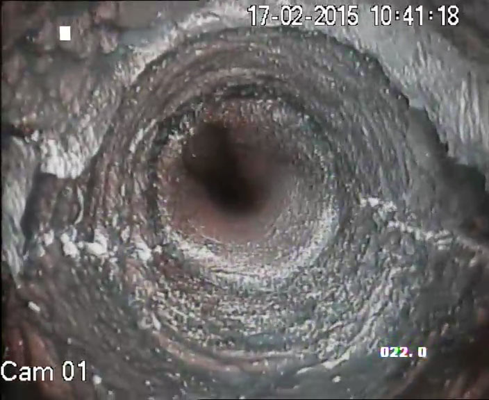
For the processing and interpretation of GPR measurements the software used will be: Slice v.7, Examiner, Reflex and Reflex3D. 2. The Mala ProEx system (Professional Explorer) with its shielded antennas of 250MHz, 500MHz, 1000MHz, 1600MHz, 2300MHz and the RTA antennas of 25-30MHz, 50MHz and 100MHz. 3. The GPR system GX HDR (Ground Explorer High Dynamic Range) with the shielded high frequency antennas of the Swedish House of Mala Geoscience, the central frequencies of which are 80MHz, 160MHz, 450MHz and 750MHz. The geophysical instrumentation used (MALA GX system), built with HDR technology, delivers unprecedented data quality and performance. For the processing and interpretation of GPR measurements the software used will be: Slice v.7, Objectmapper, Geovision and RADExplorer. 4. The Mala GPR Borehole, (Professional Explorer borehole logging system), with two pairs of optical (four-stranded) cables, 800m long each, and its un shielded borehole antennas of: 100MHz and 250MHz. measurement devices: Downhole και Crosshole. For the processing and interpretation of the measurements the software used is: Radinter and Wintomo.
The depth of the geophysical exploration, depending on the antenna used and the conductivity of the subsoil ranges from 0.30cm up to 50m. |
| Electromagnetic method EMI (Time Domain) | 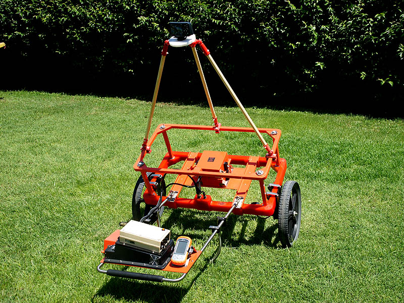
The office has two exploration systems of the company GEONICS Canada, which can perform two-dimensional and three-dimensional imaging of targets that are to be geophysically explored. The first system is the detector Geonics EM61 MK2 High Power, which is the most widely used detector for prospection UXO's and archaeometric survey. Its position is determined using the Global Positioning System RTK GPS. The system can detect metallic or non-metallic targets at depths of up to 8m, depending on their size. The second system is the detector Geonics EM63 which is mainly used for the categorization and orientation of the UXO's (unexploded explosives) or otherwise buried metal objects. 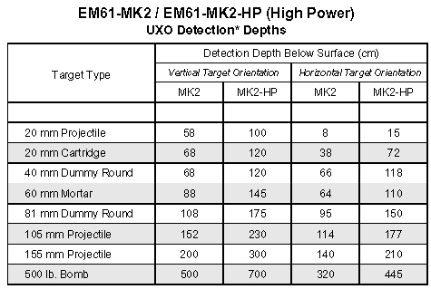  |
| Electromagnetic method SLINGRAM |
The office has two geophysical systems (EMAC 36 and HF EMAC 180) and the measurement interpretation software Slingram, of the company MALA Sweden. The emission frequencies of the two systems are 3.6 and 18.1 kHz respectively. |
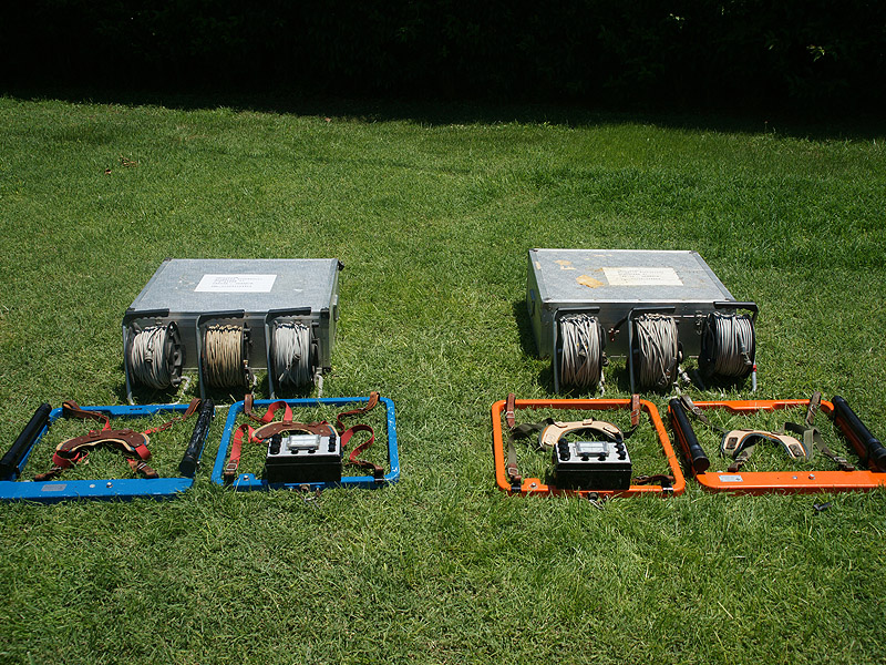
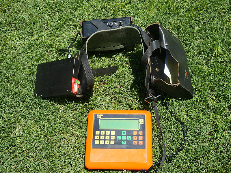
| Electromagnetic VLF method |
ΤThe office has the WADI geophysical instrument and the measurement interpretation software SECTOR and RAMAC, of the company ABEM Sweden. |
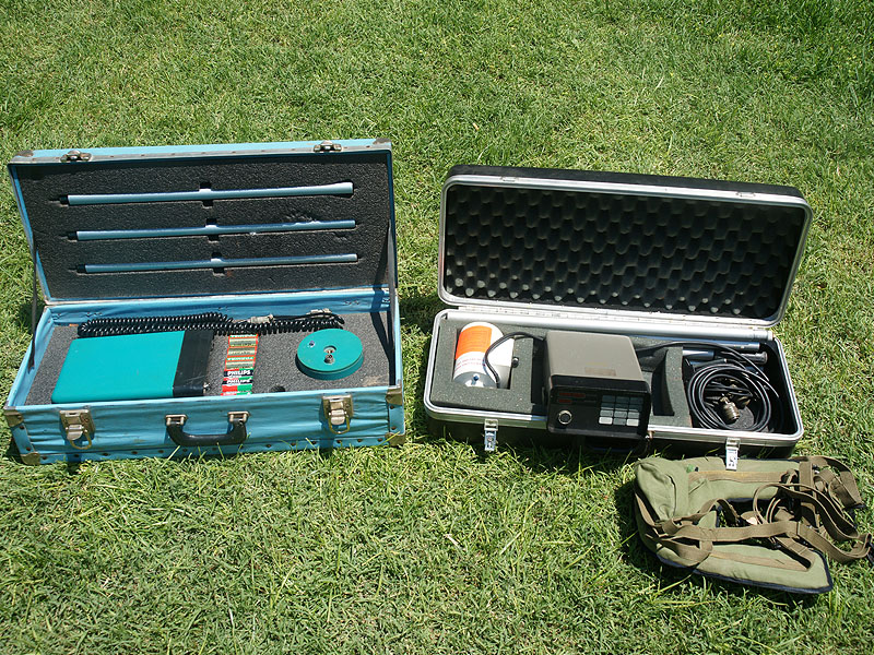
| Magnetic method |
The office has the base station, the Magnetometer – Gradiometer G856 and the measurement interpretation software MAGMAP and MAGPLOT , of the american company GEOMETRICS. |
| Seismic methods: reflection, refraction, Crosshole and Downhole |
The seismic profiles can grow to a length of up to 480 meters. |
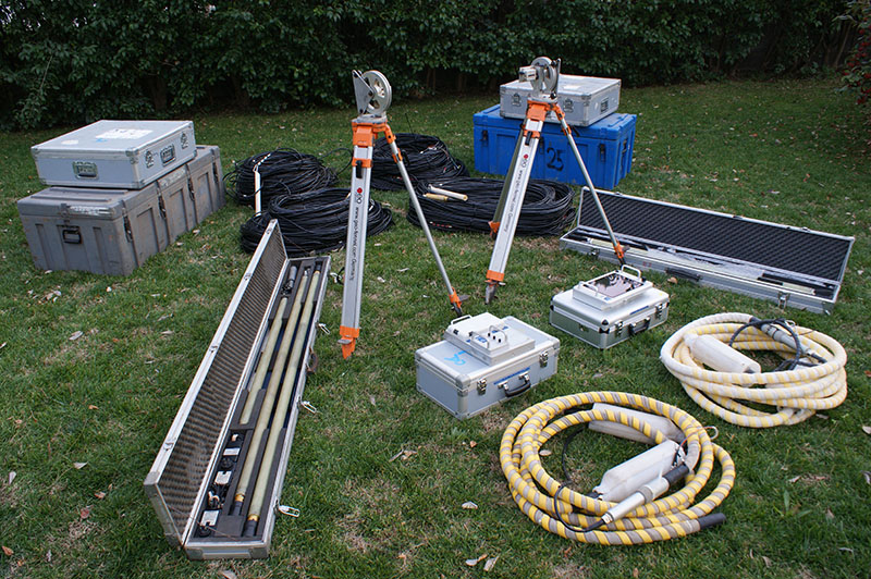
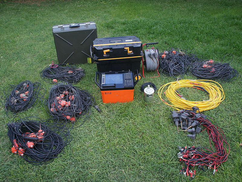
| Electrical methods: Electrical tomography, Complex resistivity and geoelectric fundoscopy of specific electrical resistance or conductivity (RES) , spontaneous potential (SP) and induced polarization (IP) |
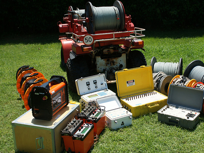
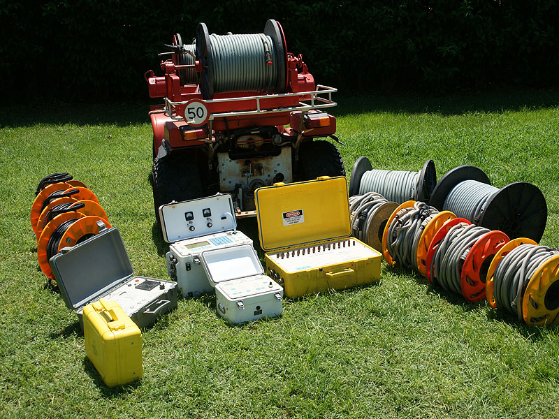
The office has the following four electrical tomography systems which can perform two-dimensional and three-dimensional imaging of the subsurface:
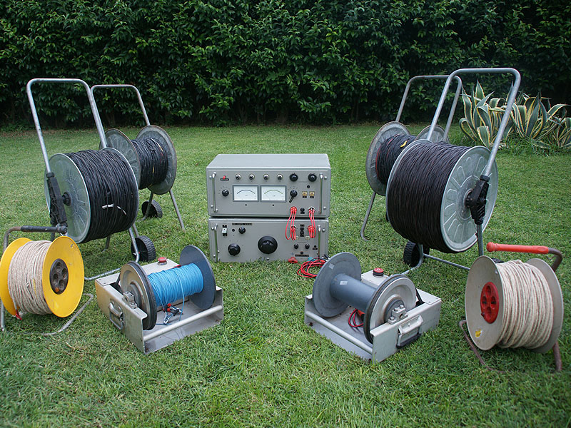
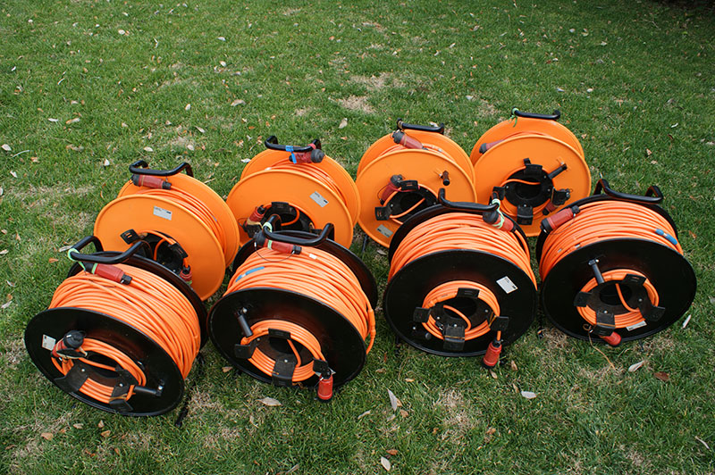
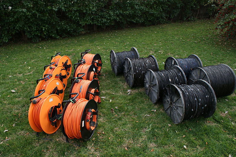
The accessories include electrodes (sold or not) and 81 electrode electrical tomography wire, spaced 2m, 5m, 10m, 25m and 50m, which make it possible that the length of scans be from 160m to 4000m from the beginning. At the same time, these cables allow us to apply the Roll along process, during which a much larger number of electrodes can be used, while at the same time the profiles of the tomographies can be developed as much as necessary in order to achieve the objectives of the geophysical research. For the interpretation and presentation of results the software used is the programs RES2DINV and RES3DINV, of GEOTOMO company. For the realization of geoelectrical depth soundings (fundoscopy) of specific electrical resistance or conductivity (RES), spontaneous potential (SP), induced polarization (IP) and electrical conductivity, and depending on the desired depth of geophysical exploration the machinery used is: Terrameter Sas 1000,Terrameter Sas 4000, Terrameter LS and the system MX-30 Multiplex Switch - GDP-32 receiver - ZT 30 Transmitter. The office has the appropriate electrodes and cable of lengths up to 5km for Wenner and Sclumberger arrays. For the interpretation of the results the software used is IPI2WIN and RESIX PLUS programs.
The depth of the geophysical survey using electrical tomography can be extended up to 700 meters. |
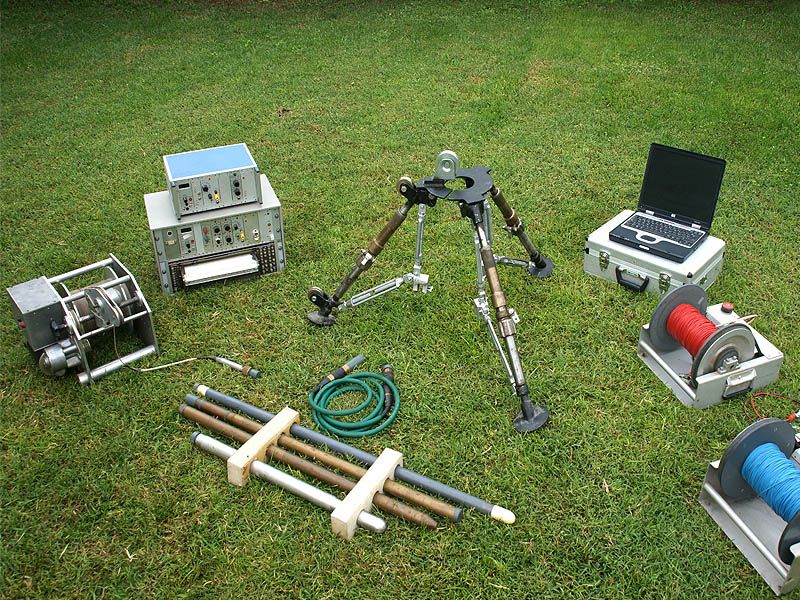
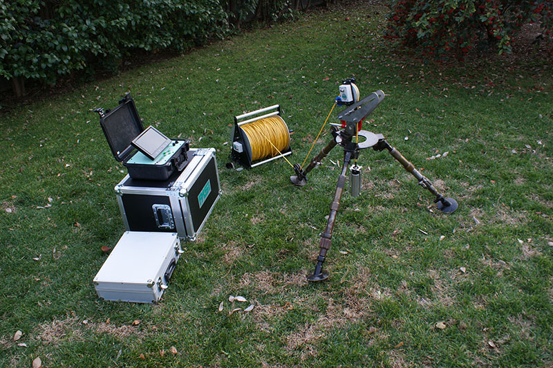
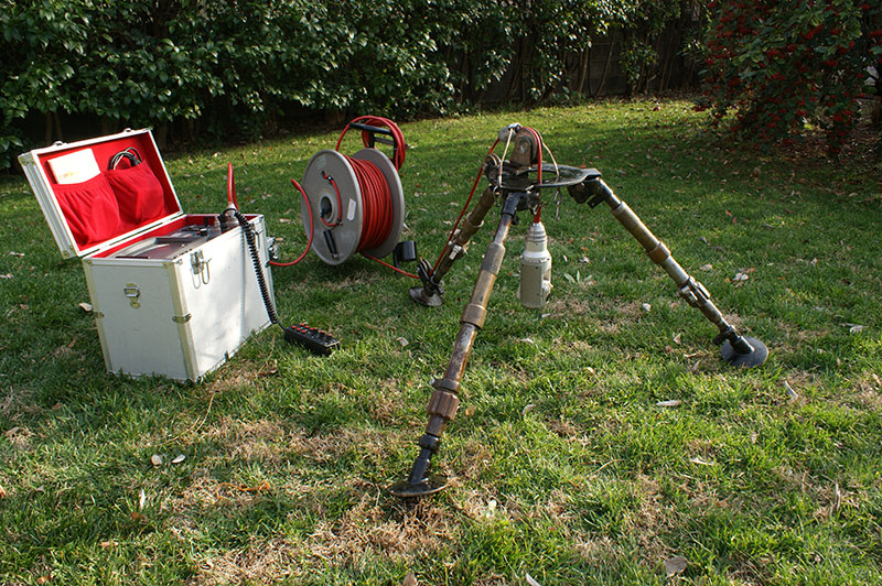
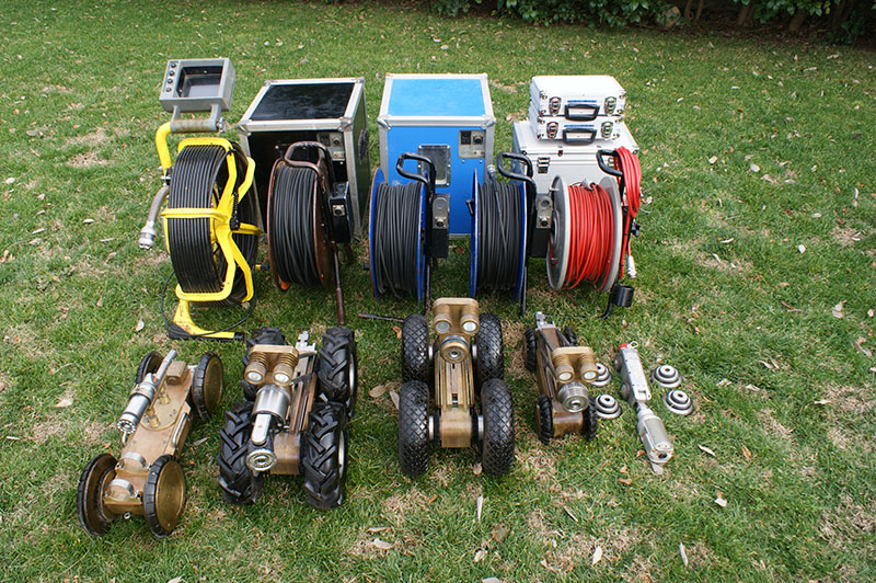
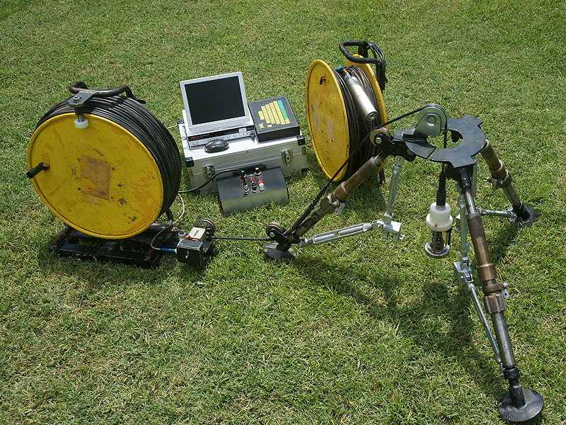
| Borehole Loggings | The office has the following systems:
|


The geophysicist equipment of our consultancy has been registered in the relevant public services, in accordance with the existing legislation. The registration form of our equipment can be shipped, upon written and substantiated request submitted by the interested party. Also, the full technical specifications of our geophysical instruments (manuals) can be sent upon request.